
|
|
|
|
Overview
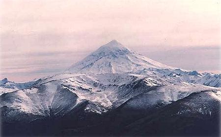
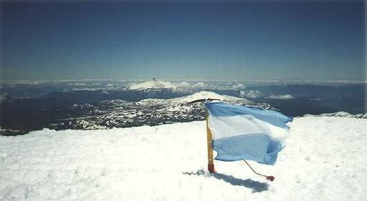
Vn.Lanin (3776 mts.) is a not in activity volcano, which basically present
two climbing routs (north -normal, and south -ice climbing). It is part of
the South - Andes mountains in Patagonia and because surrounding mountains
have about 2000 Mts. Lanin view is really beautiful. Best climbing season
is from November to March, however it is possible -with the obvious precaution,
climb it all over year.
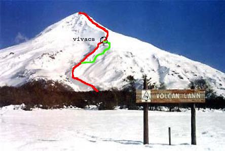
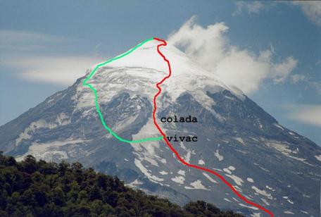
North route (map)
Base camp is
at Tromen (Argentinean-Chilean frontier), which is at about 800 mts. over
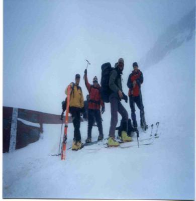
the sea level and to 60 Km from nearest city. Ski mountaineering
is possible and with good snow conditions you will have 3000 mts. to ski!.
Climb Lanin for this traverse is a quite easy hiking -red in map, however
people die because they underestimate the task at hand. On this normal route
there are no permanent snow fields, but crampons and ice axe may still be
required in some sections. In map is also indicated in green the "camino
de mulas variant", an easier and longer way to vivacs area.
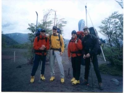
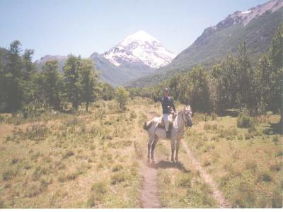
Usually I take one day from San Martin de los Andes city, Neuquen, to base
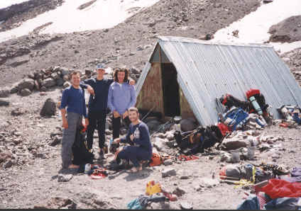
camp (100 Km by car/bus) and hike to 2400 Mts. where there are three vivacs.
Total capacity ~50. Two belong to the army ("Refugio del Batallon
de Infanteria de Montana" -2315 Mts. and "Refugio de Infanteria de Montana"
-2400 Mts) and one to local climbing club ("Refugio del Club Andino Junin
de los Andes" -2600 Mts). Second day climb to the summit and go back to home.
South route (map)
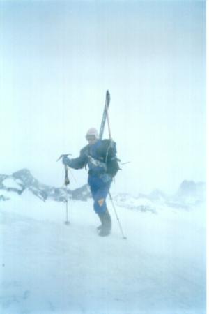
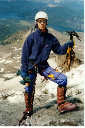
Technical climbing (AD, ice: IV) -red on map. From San Martin de los Andes
(100 Km) / Junin de los Andes (60 Km) to Huechulafquen lake (Paimun area: Puerto canoa). It
is possible go by car/bus till the ranger office (900 mts. over the sea level).
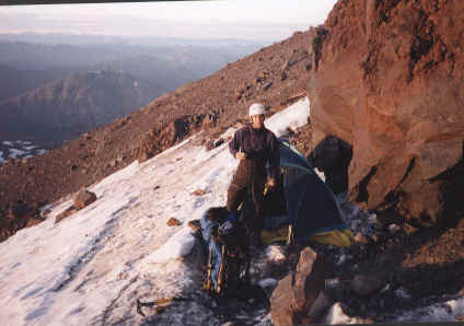
What I usually do is from there hike till 2600/2700 mts. in the first day,
it takes ~6 hours (years ago was a small vivac, however nowadays
is not because an avalanche and it is necessary to carry a tent or similar). Second day,
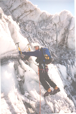
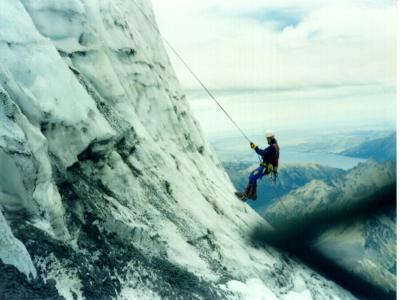
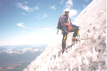
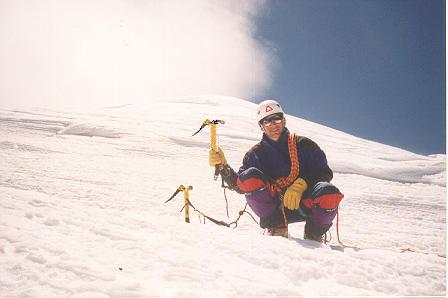
with crampons to 2850 Mts. where the "colada" is (see colada middle and colada rappel and colada superior) -quite
small ice-passage between two enormous exposed rock walls, after that ice/snow
climbing till 3400 Mts., time depend on ice conditions, which are very changeable
so it is necessary to look for the best way on the moment: "vamos viendo"
is our most used Spanish expression. From there is just a hike to the summit (be care on the last 150
mts. because of crevasses). Descent
is by the same route or by the north face or by the "Paimun variant" -green
in map.
Permits
It is not necessary any special permit to climb Lanin Volcano. During the
high season you should just paid the entrance to the National Park (from
November to April, it cost about U$5), rest of the year is for free.
You should notify your climbing plans at the ranger office: "Tromen" for the
north face, "Paimun" for the south face and sign a disclaimer form. Be care
& enjoy!.
Equipment list
Here is a brief list for you. This is approximately what I take (oriented
to the south face).
2-pairs socks
1-underware
1-pair of shorts for the walk in
1-pair t-shirts for the walk in
1-sun hat too keep off the sun
Sunscreen
Good sturdy Hiking shoes
1-sleeping bag
1-sleeping pad
1-expedition weight Patagonia long underwear tops
1-expedition weight Patagonia long underwear bottom
1 lightweight fleese bottom
1-heavy weight Patagonia or similar fleese jacket
1-Gortex shell jacket
1-Gortex shell pants (full length zippers)
1-Down filled jacket liner from Feathered Friends of Seattle, (optional but
I always end up using it)
1-Warm hat with ear flaps
1-pair of heavy duty mittens
1-pair fleese gloves
1-pair ski gloves
1-pair of Koflach double plastic boots
1-pair of gaitors
1-pair ski poles
2-ice axe
1-pair of sharp crampons (test them on your boots before you leave and make
sure they fit perfectly)
1-headlamp with extra batteries
1-cup with spoon attached
1-Swissarmy knife
1- stove of your choice
1-tent
Food....
Rope, carabiners, and the rest of the usual ice climbing stuff
First aid kit
VHF radio (recommended, ask rangers about freq.) or mobil phone (remember
you are in Patagonia ... just in case you think you will always have signal
;)